
Gallatin Previous Resident Sources by Era
Previous residents of a Gallatin address appear in different record types at different points in time. A current parcel and recorded deed establish the property trail. A city or telephone directory can place a household at an address during an available year. Census material, maps, tax lists, obituaries, probate, and permits answer narrower questions when there is no directory volume. Each source has a distinct keeper and a different limit, so use the era table as a route map rather than as proof of occupancy.
| Source | Years It Covers | Where Held | What It Shows |
|---|---|---|---|
| Register online certified record | Stated back to September 1989 | Sumner County deed portal and linked search route | Recorded instruments, subject to dynamic search and image limits |
| Sumner deed books and indexes | 1786 onward; deed-index microfilm before 1965 reported | Register counter and Sumner County Archives | Grantor, grantee, and legal-description trail |
| Gallatin directory shelf | 1948; intermittent 1960-1989 | TSLA F444.G24A | Historical name and address leads, with gaps |
| Sumner Polk directory | 2006-2014 | TSLA guide; local availability to verify | Name, address, and business lead |
| Federal census | 1820-1930 microfilm; indexes through 1940 | Sumner County Archives and library routes | Household, age, relationship, and neighborhood clues |
| Gallatin Sanborn map | January 1888, four sheets | Library of Congress online | Street and building context, not resident names |
Start with a deed for ownership, a directory for an available address year, or a census for a household question. A permit can help date work or occupancy timing inside Gallatin, but it is not a complete resident list. The City Building Codes portal requires an account, and its anonymous public search fields and historical coverage were not verified.
Gallatin Previous Residents and Parcels
Before tracing past residents, save the current parcel facts from the Tennessee Property Assessment Data search. The Sumner search path accepts a property address, owner name, or parcel ID after selecting the county. Its visible result fields include owner, property address, Control Map, Group, Parcel, Parcel ID, Subdivision, Lot, Class, and Sale Date. Preserve each identifier exactly. The legal description and parcel identifiers may survive a street-number change that defeats a plain address search.
Then use the Sumner GIS Property Search to inspect the parcel shape and nearby geometry. The viewer can link an address or parcel to map context, but the full field and tool inventory was not exposed during the research. The assessor's mailing address is a tax correspondence address, not proof that an owner lives at the Gallatin situs address. Likewise, a homestead or exemption indicator can be evidence to check, not a complete household answer.
- Situs address
- The physical location of the parcel. It can differ from the owner's mailing address.
- Parcel ID
- The assessor's parcel key. Keep the Control Map, Group, and Parcel strings with it.
- Legal description
- The lot, block, metes-and-bounds, or other title description that identifies land more steadily than a street number.
Gallatin Previous Residents in Deeds
The Sumner County Register of Deeds says online certified records reach back to September 1989. It also says deed books and indexes dating to 1786 have been digitized, while original books remain at the Register. Those statements do not mean that every old document is searchable or certified through the same web interface. The county's online portal and its linked search route did not expose complete dynamic fields, image rules, or historical cutoffs during the research.
When a Gallatin deed trail reaches the stated marker or the live search does not return an older item, use the Register counter and the Archives. The Archives reports deed and deed-index microfilm before 1965. The Register is at 355 N Belvedere Dr, Suite 201, Gallatin, with hours listed as Monday through Friday, 8 to 4:30, and phone 615-452-3892. Bring the grantor or grantee name, date range, parcel information, and any book, page, or document number already found.
Note: September 1989 is a stated certified-record marker, not a promise that all earlier Gallatin deeds are absent from every online search.
Trace Gallatin Past Owners Through Deeds
The deed chain is the land trail behind a Gallatin address. Use the current owner as a grantee, meaning the person or entity that received property, near the sale or transfer date shown by the assessor. The deed should be checked for the parties, recording date, book and page or document number, legal description, lot or block references, and image availability. The earlier seller becomes the next person to search as a grantee for the prior purchase.
- Save the current owner, sale date, parcel ID, subdivision or lot, and legal description from the assessor result.
- Search the Sumner County Register of Deeds portal for that owner as grantee around the transfer date.
- Copy the grantor, grantee, recording date, document reference, and legal description from the instrument.
- Search the prior grantor as grantee to locate that person's earlier purchase, checking name variants and related entities.
- Repeat backward, then use the Register counter or Archives microfilm when the web result, image, or certified access stops.
- Grantor
- The person or entity transferring an interest in the property.
- Grantee
- The person or entity receiving that interest.
- Chain of title
- The linked sequence of recorded transfers for the same property. It traces ownership, not every resident.
Gallatin Previous Residents and Address Changes
Old Gallatin address work can fail because the street label, segment, or number changed, not because the property vanished. E911 addresses are generally issued from driveway location, while townhomes use front-door logic. Out-of-sequence numbers can be reassigned. The legal description, subdivision, lot, and parcel identifiers are the steadier bridge between an old deed or directory and a current record.
There are documented local examples. A May 2025 city action divided Magnolia Street into North and South Magnolia, with a reviewed segment from Carson to West Eastland and an east shift near Small Street. A 2021 city item also described a location that had been platted as Elm Street but known by residents as Anderson Avenue, although neither name was formally adopted there. Search both known names and relevant segments. For an address that will not geocode, consult the official E911 address layer and compare the deed description.
Gallatin Criss-Cross Directory Requests
Deeds trace owners. A criss-cross directory, if one can be located for the right Gallatin year, is the historical address-to-occupant tool. Exact local years were not found in the research, so requesters should not assume a normal name directory has a usable street section. Ask the Bailey Room, TSLA, or a Library of Congress catalog for the directory type, Gallatin and Tennessee, and the exact year or year range needed.
The Library of Congress guide to reverse and criss-cross directories describes the directory types to specify in a request.
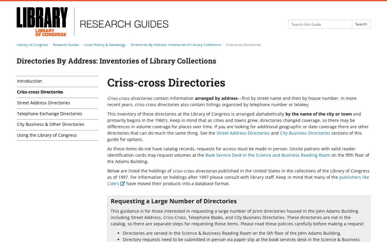
The guide reinforces a basic limit for past-resident work: an address-first request needs an address-ordered source, not merely a directory that sorts names alphabetically.
The reported Gallatin shelf includes 1948 and intermittent years from 1960 through 1989, while the Sumner Polk run covers 2006 through 2014. The collections themselves and their gaps are described in the Gallatin city directory collections.
Gallatin Past Households in Census Books
Past residents are not always past owners. Pair a directory or address lead with a census period to test who formed the household. Sumner County Archives reports federal census microfilm from 1820 through 1930, census books in neighborhood format from 1820 through 1880, and indexes through 1940. Available federal census access follows the 72-year release rule. A directory may show a name and address; a census can add age, relationship, occupation, and neighboring households.
Use the household flow in order: address or legal description, then a directory or telephone lead, then the nearest released census, then newspapers, obituaries, probate, or deeds to test a move or death. Compare several facts before joining two similar names. An occupation alone is not unique identification, and a last listing is a lead rather than proof of what happened next.
- Write down the address and every street-name variant from the parcel, deed, or map.
- Find a documented directory year near the period and record its exact wording.
- Check the nearest released census index or neighborhood-format census book at the Archives.
- Compare household members, age, relationship, occupation, and nearby names with the directory clue.
- Use obituary, probate, newspaper, or deed evidence to confirm the next transition.
Lawful use. Gallatin address history supports family history, house history, and personal curiosity. Do not use names or addresses to stalk, harass, or harm anyone.
Gallatin Previous Residents on 1888 Maps
The Library of Congress Gallatin Sanborn record offers four sheets from January 1888. A Sanborn map can show a building footprint, street name, building material, use, and fire-risk detail. It cannot identify the people who lived there. Use it to test whether a historic street, lot, or structure fits the property trail, especially when a later address is missing from a deed.
A modern ZIP is no help for nineteenth-century sources. Pair the map with a legal description, tax list, early telephone material, or the old street name. That avoids turning map context into an unsupported claim about a Gallatin household.
Gallatin Previous Residents at Archives
Sumner County Archives can close or test a past-resident trail with its obituary index, funeral-home collection, marriage index, will books, probate material, newspapers, tax lists, maps, and family files. Probate and Chancery records can identify heirs or estate context, but some files may be restricted or only indexed. The Archives also warns that it has no universal every-name index, so a targeted request works better than a broad question about everyone who lived at a house.
For remote research, the Archives accepts mail or email requests for up to five items. The posted charge is $20 for up to 30 minutes, $25 for each added half-hour, and 25 cents per copy; it gives a two-week estimate and asks researchers not to send payment before a response. Supply the address, a name if known, record type, date range, and place. The office can then say whether the evidence belongs in deeds, tax lists, maps, newspapers, probate, or another collection.
Note: A former address match should be dated and labeled by source, because owner, occupant, applicant, and heir are different roles.